Road Mortality
Surveys and Mitigation
Roads pose a major threat to local reptile and amphibian populations. Many species need to access resources available in different parts of their habitat depending on their age and the time of the year. Roads cutting through natural habitats separate animals from these resources and from other individuals, causing habitat fragmentation. This forces animals to cross roads to try and reach resources, often leading to wildlife-vehicle collisions. This is especially true in southern Ontario, which has the greatest density of roads and people in the province. In fact, you cannot travel more than 1.5 km in a straight line in southern Ontario without hitting a road! This increases the risk of vehicle collisions for reptiles and amphibians in urban areas.
Compared to other animals, reptiles and amphibians are particularly at risk of being struck by vehicles because they move slowly, bask on warm, sunny roads, and nest along road shoulders. Some species also respond to oncoming traffic by stopping in the path of vehicles, whereas others like snapping turtles will jump when threatened and hit the underside of cars if people try to drive over them. Road mortality is especially harmful for turtles as they already have a low chance of surviving to adulthood and reproducing. The death of even a small number of adults, therefore, can lead to population declines.
To better understand road mortality threats to urban reptiles and amphibians, Adopt-A-Pond has collected wildlife-vehicle collision data on roads near your Toronto Zoo. The Ontario Road Ecology Group (OREG) first surveyed these roads in 2010 and 2011, and Adopt-A-Pond conducted additional surveys from 2017 until 2021. The surveys take place along stretches of road near wetlands and green spaces. When a deceased animal is found on the road or shoulder, its precise location is recorded along with weather conditions (like precipitation and air temperature) and habitat information (such as proximity to a wetland or train tracks). Using this data, we identify areas with high numbers of collisions, called “mortality hotspots”, and model the factors that influence where and when animals decide to cross. These results tell us the best places to focus mitigation efforts.
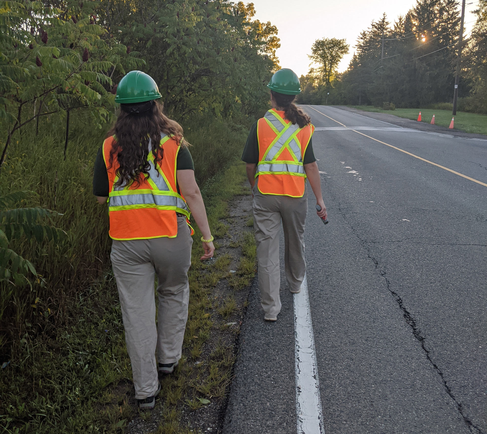
Photo: The Adopt-A-Pond team helping a common snapping turtle cross the road.
After identifying road mortality hotspots near your Toronto Zoo, Adopt-A-Pond received funding from the Species at Risk Stewardship Fund in 2018 for a mitigation project. In partnership with Parks Canada, the City of Pickering, the Toronto and Region Conservation Authority, and the University of Toronto Scarborough, we installed fencing to prevent small- and medium-sized animals from crossing the road. This fencing was installed on both sides of the road and connected to a concrete culvert that acts as an “ecopassage” allowing wildlife to cross safely. There were no instances of road mortality recorded in the year after fencing was installed, indicating that this project helped restore habitat connectivity and decrease road mortality. In 2020, we used trail cameras to successfully gather evidence of animals, including turtles and snakes, using the ecopassage! We remain committed to working with partners on more mitigation projects in the future to make roads safer for animals and drivers. This includes adding more fencing around local wetlands and installing wildlife crossing signs at mortality hotspots.
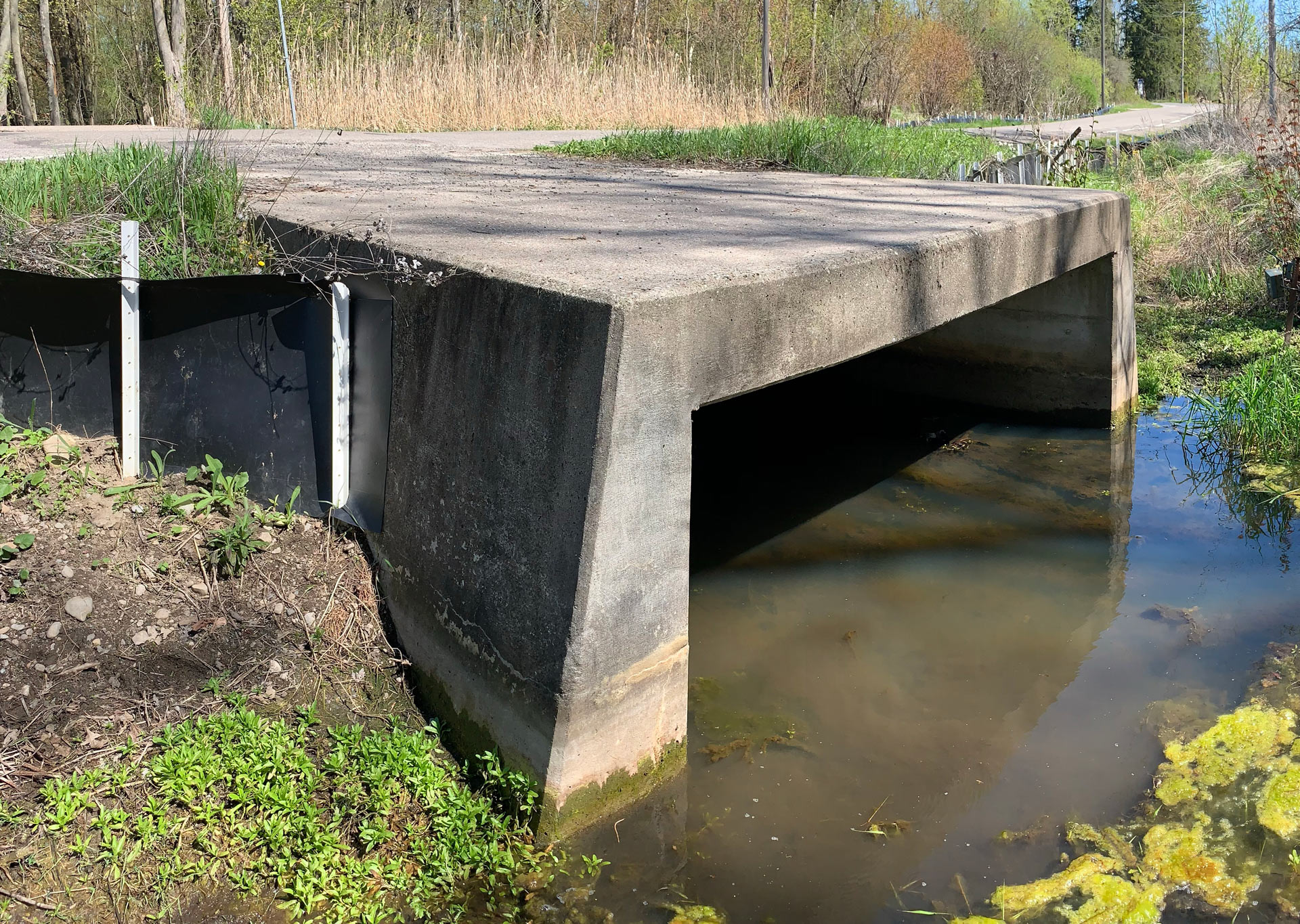
Photo: Fencing installed in 2019 on both sides of culvert to act as an eco-passage for the nearby wetland habitat.
You can help collect data on reptiles and amphibians crossing the road through Adopt-A-Pond’s Turtle Tally and FrogWatch Community Science programs. This data is shared with interested parties across Ontario to inform mitigation projects, meaning your contributions can help prevent future road mortality!
If you have data indicating a local road mortality hotspot, you can purchase our wildlife crossing signs as a first step towards mitigation.
Learn About Purchasing Crossing Signs
Partners